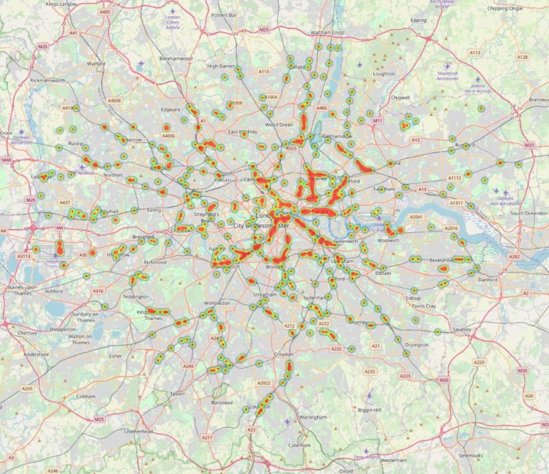
Oversized vehicles, like Heavy Goods Vehicles (HGVs) or cranes, often strike low bridges even though there is signage to warn drivers.
Our analysis suggests that, on average, there are two bridge strikes a month across London. In partnership with Ordnance Survey (OS), we have published the heights of bridges and tunnels in Greater London to help developers and fleet operators route vehicles according to their height and reducing collisions. Accurate vehicle routing will also save money in structural repairs. The release of this data forms part of our continuing work to keep the capital moving and make the city’s roads safer places for everyone.
What does it cover?
877 structures within the Greater London boundary / M25 comprising of low bridges, tunnels and road barriers.

How did our OS partnership help us with sourcing the data?
With Ordnance Survey’s permission The data was extracted from OS’s detailed road network dataset, OS MasterMap Highways Network, and manually labelled with additional information, for example, road names.
John Kimmance, OS Director of Government and Partner Engagement, explains why OS were keen to work with us to make this data open, “Everyday the public and private sector are using OS MasterMap Highways data to make better decisions about Britain’s road network. From reducing carbon emissions and fuel costs through route optimisation, to improving road safety and congestion levels, OS data is an essential source of information when maintaining a safe and efficient transport infrastructure. We are excited to see how the height data, being released by Transport for London, will be used to further improve road safety levels and minimise disruption across London’s roads and rail network.”
Permission to release the data was obtained through Ordnance Survey’s Presumption to Publish process available to Public Sector customers.
How can you use this data in your products?
You can add the data as a layer to any mapping or routing product, for example, to plan routes for freight vehicles which avoid bridges which are too low for the vehicle.
Where can you find this data?
You can find it under /bridges – restrictions on http://roads.data.tfl.gov.uk/ along with other roads related datasets. Please remember to sign up to our Transport Data Service terms and conditions before using our open data.
What format is it in?
A single static .csv file
How it will be maintained?
The data will be updated annually.
What is the data description?
The data contains the following variables:
| Variable | Description / value |
| Height restriction (m) | · Up to 3.0
· Between 3.1 and 3.5 · Between 3.6 and 4.0 · Between 4.1 and 4.5 · Between 4.6 and 5.1 |
| Height restriction (imperial) | · Up to 9’10”
· Between 9’10” and 11’6″ · Between 11’9″ and 13’0″ · Between 13’3″ and 14’9″ · Between 15’0″ and 16’6″ |
| Easting | X-coordinate |
| Northing | y-coordinate |
| Grid Reference | Grid reference value |
| Lat | Latitude value |
| Lng | Longitude value |
| Borough | Borough name |
| Road name | Road name |
| Road number | Road Number |
| TLRN [Red route]? | · Yes = restriction is located on TLRN
· No = sign is NOT located on TLRN (TLRN = Transport for London Road Network Area = Red Route, road network controlled by TfL) |
| Comments | Additional information |
Want to know more about our roads open data?
Check out related blog posts – Unified API Pt 3 – Roads and Data drop: Car parks and jam cams
As always, we love to hear what you are building with the API, or if you have any questions, so don’t hesitate to get in touch on our Tech Forum.
